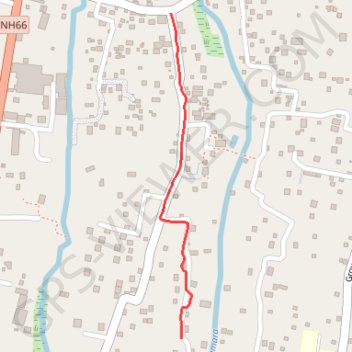
Thiruvizha
- Distance: 0.6 mi
- Elevation gain: 7 ft
- Maximum elevation: 33 ft
- Elevation loss: 7 ft
- Minimum elevation: 26 ft
- Moving time: 4 m
- Moving speed: 8.8 mph
- Maximum speed: 20.3 mph
- Total time: 4 m
- Global speed: 8.8 mph
Interactive trail map
Trail profile
- Distance: 0.6 mi
- Elevation gain: 7 ft
- Maximum elevation: 33 ft
- Elevation loss: 7 ft
- Minimum elevation: 26 ft
- Moving time: 4 m
- Moving speed: 8.8 mph
- Maximum speed: 20.3 mph
- Total time: 4 m
- Global speed: 8.8 mph
About this trail
Name: Thiruvizha trail, distance, elevation, map, profile, GPS track
Start: Koottuveli, Cherthala, Alappuzha, Kerala, 688555, India (9.63948 76.34009)
End: Cherthala, Alappuzha, Kerala, 688539, India (9.64698 76.33984)
Coordinates: 9.63948 76.33959 9.64698 76.34033
Other hiking, mountain biking, running and outdoor activity trails
Click on a trail to view its statistics, map and profile.
Thiruvizha
Distance: 2.0 mi • Elevation gain: 16 ft • Maximum elevation: 33 ft