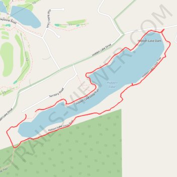
Hidden Lake Loop Trail
Description:
- Distance: 1.8 mi
- Elevation gain: 177 ft
- Maximum elevation: 686 ft
- Elevation loss: 174 ft
- Minimum elevation: 594 ft
- Moving time: 38 m 58 s
- Moving speed: 2.8 mph
- Maximum speed: 6.2 mph
- Total time: 41 m 8 s
- Global speed: 2.7 mph
Interactive trail map
Trail profile
- Distance: 1.8 mi
- Elevation gain: 177 ft
- Maximum elevation: 686 ft
- Elevation loss: 174 ft
- Minimum elevation: 594 ft
- Moving time: 38 m 58 s
- Moving speed: 2.8 mph
- Maximum speed: 6.2 mph
- Total time: 41 m 8 s
- Global speed: 2.7 mph
About this trail
Name: Hidden Lake Loop Trail trail, distance, elevation, map, profile, GPS track
Coordinates: 41.04876 -75.05548 41.05556 -75.04302
Topography: Middle Smithfield Township topographic map, elevation, terrain