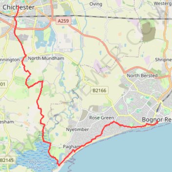
Walk from Chichester to Bognor
- Distance: 11.5 mi
- Elevation gain: 144 ft
- Maximum elevation: 66 ft
- Elevation loss: 190 ft
- Minimum elevation: -7 ft
- Moving time: 4 h 26 m
- Moving speed: 2.6 mph
- Maximum speed: 4.8 mph
- Total time: 6 h 55 m
- Global speed: 1.7 mph
Interactive trail map
Trail profile
- Distance: 11.5 mi
- Elevation gain: 144 ft
- Maximum elevation: 66 ft
- Elevation loss: 190 ft
- Minimum elevation: -7 ft
- Moving time: 4 h 26 m
- Moving speed: 2.6 mph
- Maximum speed: 4.8 mph
- Total time: 6 h 55 m
- Global speed: 1.7 mph
About this trail
Name: Walk from Chichester to Bognor trail, distance, elevation, map, profile, GPS track
Coordinates: 50.76145 -0.78230 50.83659 -0.67538