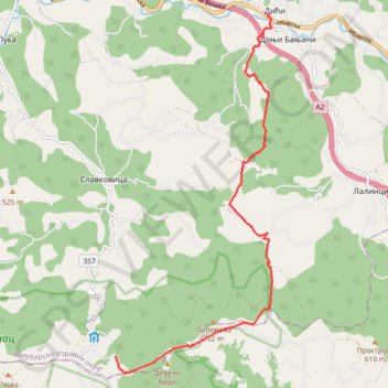
Dići - Rajac(planinarski dom)
- Distance: 6.9 mi
- Elevation gain: 2,021 ft
- Maximum elevation: 2,379 ft
- Elevation loss: 348 ft
- Minimum elevation: 646 ft
Interactive trail map
Trail profile
- Distance: 6.9 mi
- Elevation gain: 2,021 ft
- Maximum elevation: 2,379 ft
- Elevation loss: 348 ft
- Minimum elevation: 646 ft
About this trail
Name: Dići - Rajac(planinarski dom) trail, distance, elevation, map, profile, GPS track
Coordinates: 44.13649 20.25019 44.19717 20.28718
Other hiking, mountain biking, running and outdoor activity trails
Click on a trail to view its statistics, map and profile.
2022_Yu
Slovenia > Ajdovščina > Žapuže
Distance: 1,526.9 mi • Elevation gain: 105,144 ft • Maximum elevation: 6,398 ft