Nambe Lake Trail via Winsor Trail in Santa Fe National Forest
The Nambe Lake Trail offers a stunning hike through lush forests and alongside streams, with the grand finale being the pristine Nambe Lake. Starting from the Ski Santa Fe parking area, the hike meanders through a mix of towering aspens and evergreens, with views opening up to the surrounding Sangre de Cristo Mountains. The last stretch is challenging but rewarding, as the rugged, rocky ascent brings you to the peaceful alpine lake surrounded by dramatic peaks, perfect for a quiet break before heading back down. #Hiking #Mountain #River #Lake #Forest #Nature
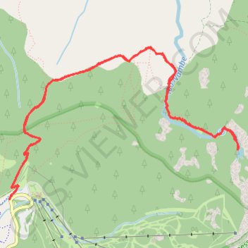
- Distance: 6.6 mi
- Elevation gain: 1,818 ft
- Maximum elevation: 11,394 ft
- Elevation loss: 1,808 ft
- Minimum elevation: 10,285 ft
- Moving time: 3 h 34 m
- Moving speed: 1.8 mph
- Maximum speed: 3.8 mph
- Total time: 4 h 29 m
- Global speed: 1.5 mph
Interactive trail map
Trail profile
- Distance: 6.6 mi
- Elevation gain: 1,818 ft
- Maximum elevation: 11,394 ft
- Elevation loss: 1,808 ft
- Minimum elevation: 10,285 ft
- Moving time: 3 h 34 m
- Moving speed: 1.8 mph
- Maximum speed: 3.8 mph
- Total time: 4 h 29 m
- Global speed: 1.5 mph
About this trail
Name: Nambe Lake Trail via Winsor Trail in Santa Fe National Forest trail, distance, elevation, map, profile, GPS track
Start: Winsor Trail (Trail 254), Santa Fe County, New Mexico, United States (35.79564 -105.80484)
End: Winsor Trail (Trail 254), Santa Fe County, New Mexico, United States (35.79582 -105.80472)
Coordinates: 35.79564 -105.80484 35.81076 -105.77682
Topography: Santa Fe County topographic map, elevation, terrain
Other hiking, mountain biking, running and outdoor activity trails
Click on a trail to view its statistics, map and profile.
Lake Peak Loop
United States > New Mexico > Santa Fe County
Wilderness hike via Tesuque Creek Trail, Santa Fe Lake, Skyline Trail, Deception Peak, Lake Peak, Penitente Peak, Winsor Trail and Vista Grande Overlook in the Pecos Wilderness. #Hiking #Loop #Nature #Wilderness #Mountain #Forest #Lake
Distance: 16.9 mi • Elevation gain: 4,705 ft • Maximum elevation: 12,323 ft
Nambe Lake - Pecos Wilderness
United States > New Mexico > Santa Fe County
Wilderness hike
Distance: 7.0 mi • Elevation gain: 1,886 ft • Maximum elevation: 11,401 ft