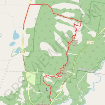
Cassidy Gap, Signal Peak, Mount Abrupt
- Distance: 11.1 mi
- Elevation gain: 2,972 ft
- Maximum elevation: 2,661 ft
- Elevation loss: 2,720 ft
- Minimum elevation: 696 ft
- Moving time: 3 h 2 m
- Moving speed: 3.6 mph
- Maximum speed: 12.6 mph
- Total time: 3 h 46 m
- Global speed: 2.9 mph
Interactive trail map
Trail profile
- Distance: 11.1 mi
- Elevation gain: 2,972 ft
- Maximum elevation: 2,661 ft
- Elevation loss: 2,720 ft
- Minimum elevation: 696 ft
- Moving time: 3 h 2 m
- Moving speed: 3.6 mph
- Maximum speed: 12.6 mph
- Total time: 3 h 46 m
- Global speed: 2.9 mph
About this trail
Name: Cassidy Gap, Signal Peak, Mount Abrupt trail, distance, elevation, map, profile, GPS track
Coordinates: -37.61909 142.32028 -37.55589 142.36781
Other hiking, mountain biking, running and outdoor activity trails
Click on a trail to view its statistics, map and profile.
The Piccaninny
Australia > Victoria > Dunkeld
Distance: 3.5 mi • Elevation gain: 830 ft • Maximum elevation: 1,348 ft