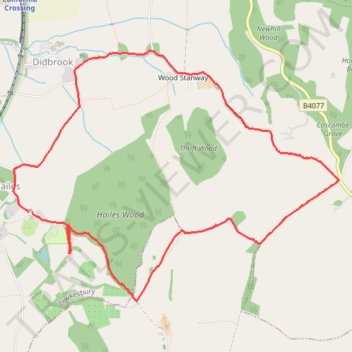
Hayles Loop Walk
- Distance: 5.1 mi
- Elevation gain: 653 ft
- Maximum elevation: 912 ft
- Elevation loss: 653 ft
- Minimum elevation: 289 ft
- Moving time: 1 h 59 m
- Moving speed: 2.6 mph
- Maximum speed: 4.6 mph
- Total time: 3 h 2 m
- Global speed: 1.7 mph
Interactive trail map
Trail profile
- Distance: 5.1 mi
- Elevation gain: 653 ft
- Maximum elevation: 912 ft
- Elevation loss: 653 ft
- Minimum elevation: 289 ft
- Moving time: 1 h 59 m
- Moving speed: 2.6 mph
- Maximum speed: 4.6 mph
- Total time: 3 h 2 m
- Global speed: 1.7 mph
About this trail
Name: Hayles Loop Walk trail, distance, elevation, map, profile, GPS track
Coordinates: 51.96306 -1.93002 51.98147 -1.89119
Other hiking, mountain biking, running and outdoor activity trails
Click on a trail to view its statistics, map and profile.
Broadway ➡️ Wood Stanway ➡️ Cutsdean ➡️ Broadway
United Kingdom > England > Worcestershire > Wychavon > Broadway
Distance: 15.2 mi • Elevation gain: 1,985 ft • Maximum elevation: 997 ft
Dean2023-311
United Kingdom > England > Oxfordshire > Oxford
Distance: 192.8 mi • Elevation gain: 11,043 ft • Maximum elevation: 951 ft