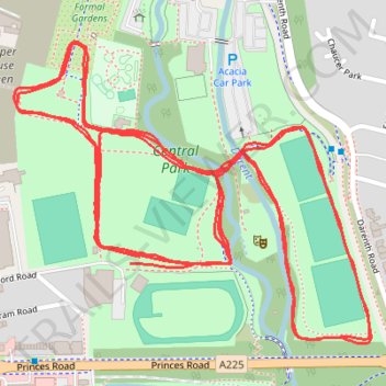
Dartford Parkrun
- Distance: 3.1 mi
- Elevation gain: 118 ft
- Maximum elevation: 66 ft
- Elevation loss: 118 ft
- Minimum elevation: 16 ft
- Moving time: 31 m 13 s
- Moving speed: 6.0 mph
- Maximum speed: 8.9 mph
- Total time: 31 m 13 s
- Global speed: 6.0 mph
Interactive trail map
Trail profile
- Distance: 3.1 mi
- Elevation gain: 118 ft
- Maximum elevation: 66 ft
- Elevation loss: 118 ft
- Minimum elevation: 16 ft
- Moving time: 31 m 13 s
- Moving speed: 6.0 mph
- Maximum speed: 8.9 mph
- Total time: 31 m 13 s
- Global speed: 6.0 mph
About this trail
Name: Dartford Parkrun trail, distance, elevation, map, profile, GPS track
Coordinates: 51.43810 0.21696 51.44231 0.22493