Make a donation
Gear up for your next adventure:
As an Amazon Associate, this site earns from qualifying purchases at no extra cost to you.
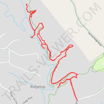
Ridgetop Horse trails
- Distance: 6.1 mi
- Elevation gain: 515 ft
- Maximum elevation: 1,617 ft
- Elevation loss: 515 ft
- Minimum elevation: 1,532 ft
- Moving time: 2 h 3 m
- Moving speed: 3.0 mph
- Maximum speed: 8.2 mph
- Total time: 6 h 11 m
- Global speed: 1.0 mph
Interactive trail map
Make a donation
Gear up for your next adventure:
As an Amazon Associate, this site earns from qualifying purchases at no extra cost to you.
Trail profile
- Distance: 6.1 mi
- Elevation gain: 515 ft
- Maximum elevation: 1,617 ft
- Elevation loss: 515 ft
- Minimum elevation: 1,532 ft
- Moving time: 2 h 3 m
- Moving speed: 3.0 mph
- Maximum speed: 8.2 mph
- Total time: 6 h 11 m
- Global speed: 1.0 mph
Make a donation
Gear up for your next adventure:
As an Amazon Associate, this site earns from qualifying purchases at no extra cost to you.
About this trail
Name: Ridgetop Horse trails trail, distance, elevation, map, profile, GPS track
Start: Private, Ridgetop, Fentress County, Middle Tennessee, Tennessee, United States (36.45051 -84.84040)
End: Private, Ridgetop, Fentress County, Middle Tennessee, Tennessee, United States (36.45053 -84.84040)
Coordinates: 36.45042 -84.84890 36.46334 -84.84030
Topography: Fentress County topographic map, elevation, terrain
Make a donation
Gear up for your next adventure:
As an Amazon Associate, this site earns from qualifying purchases at no extra cost to you.