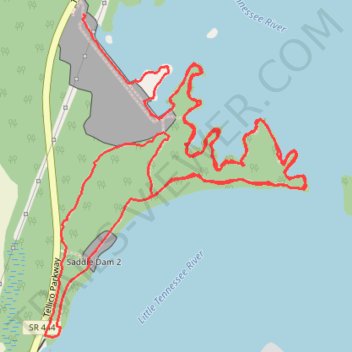
Walking the Boy Scout Trail
- Distance: 6.4 mi
- Elevation gain: 479 ft
- Maximum elevation: 896 ft
- Elevation loss: 469 ft
- Minimum elevation: 781 ft
- Moving time: 2 h 50 m
- Moving speed: 2.2 mph
- Maximum speed: 6.3 mph
- Total time: 3 h 13 m
- Global speed: 2.0 mph
Interactive trail map
Trail profile
- Distance: 6.4 mi
- Elevation gain: 479 ft
- Maximum elevation: 896 ft
- Elevation loss: 469 ft
- Minimum elevation: 781 ft
- Moving time: 2 h 50 m
- Moving speed: 2.2 mph
- Maximum speed: 6.3 mph
- Total time: 3 h 13 m
- Global speed: 2.0 mph
About this trail
Name: Walking the Boy Scout Trail trail, distance, elevation, map, profile, GPS track
Coordinates: 35.76046 -84.26810 35.77389 -84.25483
Topography: Loudon County topographic map, elevation, terrain