
Walking @ North Yorkshire
18 October 2026 10:48
17.7 km in 5h 2m, ⇡241 m, ⇣316 m
Avg moving 4.3 km/h, Max 5.5 km/h, 126 (max 165) bpm
- Distance: 11.0 mi
- Elevation gain: 915 ft
- Maximum elevation: 915 ft
- Elevation loss: 1,168 ft
- Minimum elevation: 289 ft
- Moving time: 4 h 17 m
- Moving speed: 2.6 mph
- Maximum speed: 4.2 mph
- Total time: 5 h 2 m
- Global speed: 2.2 mph
Interactive trail map
Trail profile
- Distance: 11.0 mi
- Elevation gain: 915 ft
- Maximum elevation: 915 ft
- Elevation loss: 1,168 ft
- Minimum elevation: 289 ft
- Moving time: 4 h 17 m
- Moving speed: 2.6 mph
- Maximum speed: 4.2 mph
- Total time: 5 h 2 m
- Global speed: 2.2 mph
About this trail
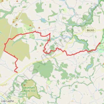
Name: Walking @ North Yorkshire trail, distance, elevation, map, profile, GPS track
Coordinates: 54.09083 -1.71381 54.12358 -1.58486