Goldstream Falls
Goldstream Provincial Park. #Hiking #Loop #Goldstream
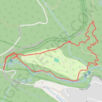
- Distance: 3.4 mi
- Elevation gain: 518 ft
- Maximum elevation: 430 ft
- Elevation loss: 518 ft
- Minimum elevation: 213 ft
Interactive trail map
Trail profile
- Distance: 3.4 mi
- Elevation gain: 518 ft
- Maximum elevation: 430 ft
- Elevation loss: 518 ft
- Minimum elevation: 213 ft
About this trail
Name: Goldstream Falls trail, distance, elevation, map, profile, GPS track
Coordinates: 48.45980 -123.57377 48.46797 -123.55447
Other hiking, mountain biking, running and outdoor activity trails
Click on a trail to view its statistics, map and profile.
Waugh Creek Falls from Humpback Reservoir
Canada > British Columbia > Capital Regional District > Langford
Sooke Hills Wilderness Regional Park. #Hiking #MTB #WaughCreek #Humpback #SookeHills
Distance: 3.5 mi • Elevation gain: 623 ft • Maximum elevation: 541 ft
BBF loop to the Skydeck in Nanaimo
Canada > British Columbia > Cowichan Valley Regional District > Area A (Mill Bay / Malahat) > Mill Bay
BBF loop to the Skydeck
Distance: 201.0 mi • Elevation gain: 20,413 ft • Maximum elevation: 2,316 ft