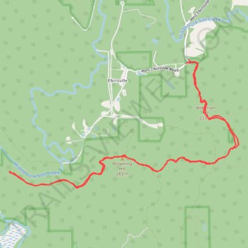
Hike of Browning Hill Trail via Wilkerson Hill and Nebo Ridge Trail
- Distance: 9.0 mi
- Elevation gain: 1,056 ft
- Maximum elevation: 915 ft
- Elevation loss: 1,106 ft
- Minimum elevation: 554 ft
Interactive trail map
Trail profile
- Distance: 9.0 mi
- Elevation gain: 1,056 ft
- Maximum elevation: 915 ft
- Elevation loss: 1,106 ft
- Minimum elevation: 554 ft
About this trail
Name: Hike of Browning Hill Trail via Wilkerson Hill and Nebo Ridge Trail trail, distance, elevation, map, profile, GPS track
Start: West Elkinsville Road, Elkinsville, Brown County, Indiana, 47448, United States (39.07871 -86.24923)
End: 158, West Elkinsville Road, Brown County, Indiana, 47448, United States (39.07919 -86.24867)
Coordinates: 39.05932 -86.28442 39.07919 -86.23865
Topography: Brown County topographic map, elevation, terrain