Bruce Ridge Nature Reserve
#Hiking #Loop #BruceRidge
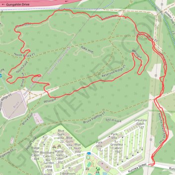
- Distance: 1.9 mi
- Elevation gain: 174 ft
- Maximum elevation: 2,159 ft
- Elevation loss: 174 ft
- Minimum elevation: 1,982 ft
- Moving time: 1 h 5 m
- Moving speed: 1.7 mph
- Maximum speed: 2.9 mph
- Total time: 1 h 13 m
- Global speed: 1.5 mph
Interactive trail map
Trail profile
- Distance: 1.9 mi
- Elevation gain: 174 ft
- Maximum elevation: 2,159 ft
- Elevation loss: 174 ft
- Minimum elevation: 1,982 ft
- Moving time: 1 h 5 m
- Moving speed: 1.7 mph
- Maximum speed: 2.9 mph
- Total time: 1 h 13 m
- Global speed: 1.5 mph
About this trail
Name: Bruce Ridge Nature Reserve trail, distance, elevation, map, profile, GPS track
Coordinates: -35.25728 149.10195 -35.25231 149.10824
Other hiking, mountain biking, running and outdoor activity trails
Click on a trail to view its statistics, map and profile.
Cloudride24.FINAL
Distance: 639.3 mi • Elevation gain: 69,823 ft • Maximum elevation: 5,755 ft