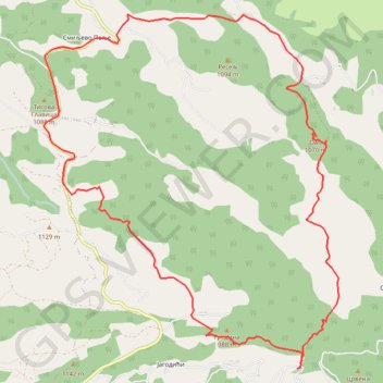
Povlen: OAB 1070m, kanjon Rogačice, Zarožje
- Distance: 8.8 mi
- Elevation gain: 2,635 ft
- Maximum elevation: 3,520 ft
- Elevation loss: 2,631 ft
- Minimum elevation: 1,909 ft
Interactive trail map
Trail profile
- Distance: 8.8 mi
- Elevation gain: 2,635 ft
- Maximum elevation: 3,520 ft
- Elevation loss: 2,631 ft
- Minimum elevation: 1,909 ft
About this trail
Name: Povlen: OAB 1070m, kanjon Rogačice, Zarožje trail, distance, elevation, map, profile, GPS track
Coordinates: 44.09586 19.65800 44.13052 19.69820
Other hiking, mountain biking, running and outdoor activity trails
Click on a trail to view its statistics, map and profile.
2022_Yu
Slovenia > Ajdovščina > Žapuže
Distance: 1,526.9 mi • Elevation gain: 105,144 ft • Maximum elevation: 6,398 ft
Povlen/Zarožje-Roge-kanjon Rogačice-Oab
Serbia > Central Serbia > Zlatibor Administrative District > Bajina Basta Municipality > Zarozje > Смиљево Поље
Distance: 10.8 mi • Elevation gain: 2,982 ft • Maximum elevation: 3,448 ft