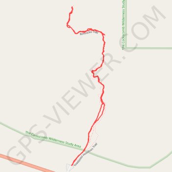
Toadstool Hoodoos Trail and Rimrocks Trail
The Toadstool Hoodoos and Rimrocks Trails in the Grand Staircase-Escalante National Monument offers a short but stunning hike through a landscape of colorful, mushroom-like rock formations. As you follow the easy path, you'll traverse expansive badlands and cross small washes, with the towering toadstools providing a captivating sight, especially when you round the bend to the first one. The trail, while mostly flat, features unique views of the surrounding canyon and cliffs, making it a rewarding yet accessible experience for all hikers. #Hiking #Desert #Rock #Nature
- Distance: 1.7 mi
- Elevation gain: 233 ft
- Maximum elevation: 4,633 ft
- Elevation loss: 233 ft
- Minimum elevation: 4,472 ft
- Moving time: 42 m 11 s
- Moving speed: 2.4 mph
- Maximum speed: 7.4 mph
- Total time: 54 m 41 s
- Global speed: 1.9 mph
Interactive trail map
Trail profile
About this trail
Name: Toadstool Hoodoos Trail and Rimrocks Trail trail, distance, elevation, map, profile, GPS track
Coordinates: 37.10128 -111.87354 37.10985 -111.87095
Topography: Kane County topographic map, elevation, terrain