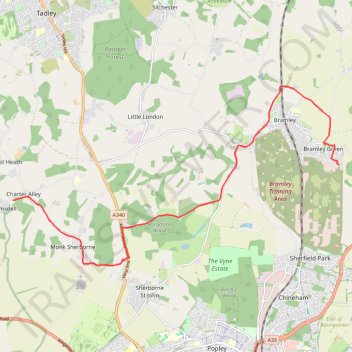
Ramsdell to Bramley Cycling
- Distance: 8.1 mi
- Elevation gain: 282 ft
- Maximum elevation: 335 ft
- Elevation loss: 404 ft
- Minimum elevation: 177 ft
- Moving time: 35 m 53 s
- Moving speed: 13.5 mph
- Maximum speed: 36.0 mph
- Total time: 39 m 53 s
- Global speed: 12.2 mph
Interactive trail map
Trail profile
- Distance: 8.1 mi
- Elevation gain: 282 ft
- Maximum elevation: 335 ft
- Elevation loss: 404 ft
- Minimum elevation: 177 ft
- Moving time: 35 m 53 s
- Moving speed: 13.5 mph
- Maximum speed: 36.0 mph
- Total time: 39 m 53 s
- Global speed: 12.2 mph
About this trail
Name: Ramsdell to Bramley Cycling trail, distance, elevation, map, profile, GPS track
Coordinates: 51.30047 -1.15108 51.33761 -1.04311