Import a GPX file

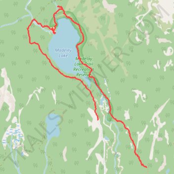
Loop trail around Madeley Lake

  • Distance: 3.8 mi
  • Elevation gain: 482 ft
  • Maximum elevation: 3,435 ft
  • Elevation loss: 663 ft
  • Minimum elevation: 3,173 ft
  • Moving time: 1 h 32 m
  • Moving speed: 2.5 mph
  • Maximum speed: 3.9 mph
  • Total time: 2 h 38 m
  • Global speed: 1.4 mph

Interactive trail map

Trail profile

  • Distance: 3.8 mi
  • Elevation gain: 482 ft
  • Maximum elevation: 3,435 ft
  • Elevation loss: 663 ft
  • Minimum elevation: 3,173 ft
  • Moving time: 1 h 32 m
  • Moving speed: 2.5 mph
  • Maximum speed: 3.9 mph
  • Total time: 2 h 38 m
  • Global speed: 1.4 mph

About this trail

Other hiking, mountain biking, running and outdoor activity trails

Click on a trail to view its statistics, map and profile.

Nordic backcountry ski on Into Woods trail

Canada > British Columbia > Squamish-Lillooet Regional District > Area D (Elaho/Garibaldi)

Backcountry ski via Into Woods, Woods Lake, Out of Woods, Howe It Goes and Madeley Lake FSR in the Coast Mountains. #Ski #Mountain #Nature #Forest #Lake

Distance: 7.0 mi • Elevation gain: 850 ft • Maximum elevation: 3,832 ft

Vancouver - Golden

Canada > British Columbia > Metro Vancouver Regional District > Vancouver

#Bike #Vancouver #Golden

Distance: 514.2 mi • Elevation gain: 30,761 ft • Maximum elevation: 4,419 ft

Gear up for your next adventure:

Backpacking Tents - Weight-optimized shelters for multi-day topographic surveys
🏔️Mountain Trail Maps - High‑detail maps for popular peaks
Camping Coffee Makers - Enjoy premium coffee at the summit or campsite
🏕️Family Camping Gear - Essentials for group camping trips
📚Navigation Handbooks - Master the art of reading topographic maps and using a compass

As an Amazon Associate, this site earns from qualifying purchases at no extra cost to you.