Mount Ida Loop
Interactive trail map
Trail profile
- Distance: 19.0 mi
- Elevation gain: 4,393 ft
- Maximum elevation: 5,039 ft
- Elevation loss: 4,390 ft
- Minimum elevation: 1,768 ft
About this trail
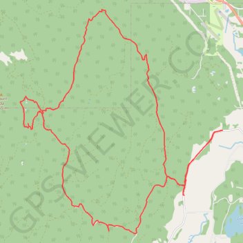
Name: Mount Ida Loop trail, distance, elevation, map, profile, GPS track
Coordinates: 50.59915 -119.29944 50.66179 -119.21029
Other hiking, mountain biking, running and outdoor activity trails
Click on a trail to view its statistics, map and profile.