Port-aux-Basques - Robinson's Junction
Gulf of Saint Lawrence. #Bike #PortAuxBasques #RobinsonsJunction #Newfoundland #SaintLawrence #Atlantic
- Distance: 66.3 mi
- Elevation gain: 2,503 ft
- Maximum elevation: 643 ft
- Elevation loss: 2,247 ft
- Minimum elevation: 0 ft
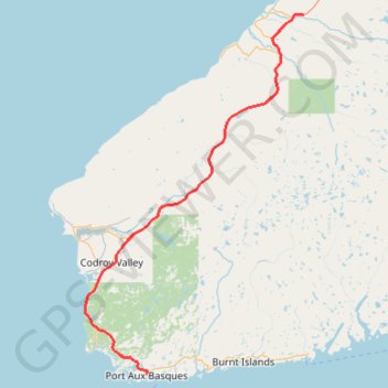
Interactive trail map
Trail profile
- Distance: 66.3 mi
- Elevation gain: 2,503 ft
- Maximum elevation: 643 ft
- Elevation loss: 2,247 ft
- Minimum elevation: 0 ft
About this trail
Name: Port-aux-Basques - Robinson's Junction trail, distance, elevation, map, profile, GPS track
End: Trans Canada Highway, Newfoundland, Newfoundland and Labrador, Canada (48.24350 -58.71026)
Coordinates: 47.58077 -59.30994 48.24361 -58.71026