Middle Fork Lytle Creek Trail to Commanche Camp
- Distance: 7.4 mi
- Elevation gain: 2,661 ft
- Maximum elevation: 6,237 ft
- Elevation loss: 2,664 ft
- Minimum elevation: 3,996 ft
- Moving time: 3 h 45 m
- Moving speed: 2.0 mph
- Maximum speed: 4.7 mph
- Total time: 4 h 31 m
- Global speed: 1.6 mph
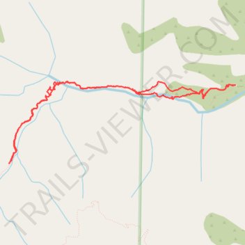
Interactive trail map
Trail profile
- Distance: 7.4 mi
- Elevation gain: 2,661 ft
- Maximum elevation: 6,237 ft
- Elevation loss: 2,664 ft
- Minimum elevation: 3,996 ft
- Moving time: 3 h 45 m
- Moving speed: 2.0 mph
- Maximum speed: 4.7 mph
- Total time: 4 h 31 m
- Global speed: 1.6 mph
About this trail
Name: Middle Fork Lytle Creek Trail to Commanche Camp trail, distance, elevation, map, profile, GPS track
Coordinates: 34.24231 -117.58010 34.25426 -117.54016
Topography: San Bernardino County topographic map, elevation, terrain
Other hiking, mountain biking, running and outdoor activity trails
Click on a trail to view its statistics, map and profile.