Blue Mountain Peak (Jamaica's highest summit)
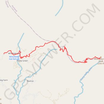
Interactive trail map
Trail profile
- Distance: 10.6 mi
- Elevation gain: 4,403 ft
- Maximum elevation: 7,326 ft
- Elevation loss: 4,403 ft
- Minimum elevation: 4,016 ft
About this trail
Name: Blue Mountain Peak (Jamaica's highest summit) trail, distance, elevation, map, profile, GPS track
Start: Whitfield Hall Road, Whitfield Hall, Saint Thomas, Surrey County, Jamaica (18.04827 -76.62270)
End: Whitfield Hall Road, Whitfield Hall, Saint Thomas, Surrey County, Jamaica (18.04827 -76.62270)
Coordinates: 18.04459 -76.62270 18.05371 -76.57922