Ostrvica preko Zagađa
- Distance: 5.7 mi
- Elevation gain: 1,604 ft
- Maximum elevation: 2,300 ft
- Elevation loss: 1,608 ft
- Minimum elevation: 1,056 ft
- Moving time: 3 h 9 m
- Moving speed: 1.8 mph
- Maximum speed: 15.1 mph
- Total time: 4 h 46 m
- Global speed: 1.2 mph
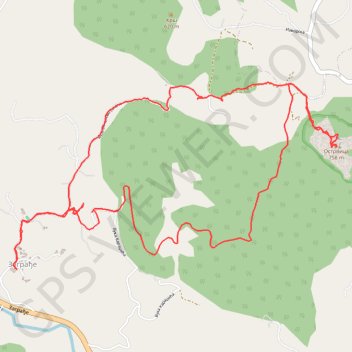
Interactive trail map
Trail profile
- Distance: 5.7 mi
- Elevation gain: 1,604 ft
- Maximum elevation: 2,300 ft
- Elevation loss: 1,608 ft
- Minimum elevation: 1,056 ft
- Moving time: 3 h 9 m
- Moving speed: 1.8 mph
- Maximum speed: 15.1 mph
- Total time: 4 h 46 m
- Global speed: 1.2 mph
About this trail
Name: Ostrvica preko Zagađa trail, distance, elevation, map, profile, GPS track
Coordinates: 44.16160 20.43390 44.17262 20.46066
Other hiking, mountain biking, running and outdoor activity trails
Click on a trail to view its statistics, map and profile.
Ostrvica,Rudnik
Serbia > Central Serbia > Moravica Administrative District > Gornji Milanovac Municipality > Varnice
Distance: 0.9 mi • Elevation gain: 456 ft • Maximum elevation: 2,300 ft
2022_Yu
Slovenia > Ajdovščina > Žapuže
Distance: 1,526.9 mi • Elevation gain: 105,144 ft • Maximum elevation: 6,398 ft