Make a donation
Gear up for your next adventure:
As an Amazon Associate, this site earns from qualifying purchases at no extra cost to you.
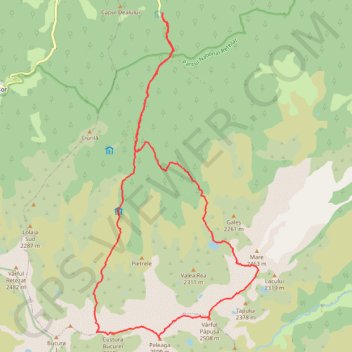
Carnic - Lacul Pietrele - vf. Peleaga - vf.Papusa - Portile ...
- Distance: 16.2 mi
- Elevation gain: 6,414 ft
- Maximum elevation: 8,169 ft
- Elevation loss: 6,394 ft
- Minimum elevation: 3,255 ft
- Moving time: 8 h 39 m
- Moving speed: 1.9 mph
- Maximum speed: 5.5 mph
- Total time: 13 h 56 m
- Global speed: 1.2 mph
Interactive trail map
Make a donation
Gear up for your next adventure:
As an Amazon Associate, this site earns from qualifying purchases at no extra cost to you.
Trail profile
- Distance: 16.2 mi
- Elevation gain: 6,414 ft
- Maximum elevation: 8,169 ft
- Elevation loss: 6,394 ft
- Minimum elevation: 3,255 ft
- Moving time: 8 h 39 m
- Moving speed: 1.9 mph
- Maximum speed: 5.5 mph
- Total time: 13 h 56 m
- Global speed: 1.2 mph
Make a donation
Gear up for your next adventure:
As an Amazon Associate, this site earns from qualifying purchases at no extra cost to you.
About this trail
Name: Carnic - Lacul Pietrele - vf. Peleaga - vf.Papusa - Portile ... trail, distance, elevation, map, profile, GPS track
Start: Popasul Cârnic, DJ667A, Sălașu de Sus, Hunedoara, 337423, Romania (45.43481 22.89392)
End: Popasul Cârnic, DJ667A, Sălașu de Sus, Hunedoara, 337423, Romania (45.43464 22.89377)
Coordinates: 45.36557 22.87278 45.43481 22.92277
Make a donation
Gear up for your next adventure:
As an Amazon Associate, this site earns from qualifying purchases at no extra cost to you.
Other hiking, mountain biking, running and outdoor activity trails
Click on a trail to view its statistics, map and profile.
Carnic - Peleaga - Bucura1 - Retezat - Muntii Retezat
Romania > Hunedoara > Sălașu de Sus
Distance: 16.2 mi • Elevation gain: 6,650 ft • Maximum elevation: 8,169 ft
Carnic - vârful Retezat
Romania > Hunedoara > Sălașu de Sus
Distance: 13.2 mi • Elevation gain: 5,259 ft • Maximum elevation: 8,120 ft