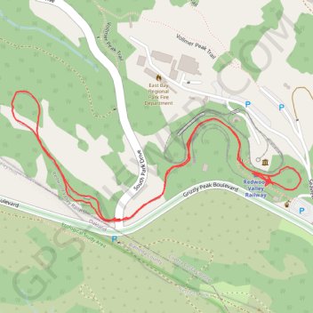
Redwood Valley Railway
- Distance: 1.2 mi
- Elevation gain: 105 ft
- Maximum elevation: 1,660 ft
- Elevation loss: 102 ft
- Minimum elevation: 1,578 ft
- Moving time: 17 m 12 s
- Moving speed: 4.2 mph
- Maximum speed: 22.9 mph
- Total time: 17 m 12 s
- Global speed: 4.2 mph
Interactive trail map
Trail profile
- Distance: 1.2 mi
- Elevation gain: 105 ft
- Maximum elevation: 1,660 ft
- Elevation loss: 102 ft
- Minimum elevation: 1,578 ft
- Moving time: 17 m 12 s
- Moving speed: 4.2 mph
- Maximum speed: 22.9 mph
- Total time: 17 m 12 s
- Global speed: 4.2 mph
About this trail
Name: Redwood Valley Railway trail, distance, elevation, map, profile, GPS track
Coordinates: 37.87976 -122.22838 37.88199 -122.22210
Topography: Contra Costa County topographic map, elevation, terrain