Latimer Pond
- Distance: 3.8 mi
- Elevation gain: 89 ft
- Maximum elevation: 180 ft
- Elevation loss: 85 ft
- Minimum elevation: 141 ft
- Moving time: 1 h 51 m
- Moving speed: 2.0 mph
- Maximum speed: 3.2 mph
- Total time: 2 h 15 m
- Global speed: 1.7 mph
Interactive trail map
Trail profile
- Distance: 3.8 mi
- Elevation gain: 89 ft
- Maximum elevation: 180 ft
- Elevation loss: 85 ft
- Minimum elevation: 141 ft
- Moving time: 1 h 51 m
- Moving speed: 2.0 mph
- Maximum speed: 3.2 mph
- Total time: 2 h 15 m
- Global speed: 1.7 mph
About this trail
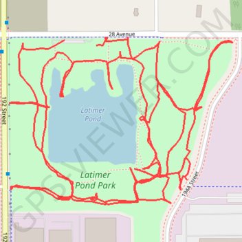
Name: Latimer Pond trail, distance, elevation, map, profile, GPS track
Coordinates: 49.04885 -122.69132 49.05282 -122.68322
Other hiking, mountain biking, running and outdoor activity trails
Click on a trail to view its statistics, map and profile.
Tsawwassen - Chilliwack
Canada > British Columbia > Metro Vancouver Regional District
Distance: 61.4 mi • Elevation gain: 1,640 ft • Maximum elevation: 413 ft