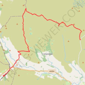
Hike from Buttertubs Pass to Garsdale via Great Shunner Fell and Lunds Fell
- Distance: 12.3 mi
- Elevation gain: 1,293 ft
- Maximum elevation: 2,349 ft
- Elevation loss: 1,877 ft
- Minimum elevation: 1,007 ft
- Moving time: 5 h 19 m
- Moving speed: 2.3 mph
- Maximum speed: 23.1 mph
- Total time: 6 h 49 m
- Global speed: 1.8 mph
Interactive trail map
Trail profile
- Distance: 12.3 mi
- Elevation gain: 1,293 ft
- Maximum elevation: 2,349 ft
- Elevation loss: 1,877 ft
- Minimum elevation: 1,007 ft
- Moving time: 5 h 19 m
- Moving speed: 2.3 mph
- Maximum speed: 23.1 mph
- Total time: 6 h 49 m
- Global speed: 1.8 mph
About this trail
Name: Hike from Buttertubs Pass to Garsdale via Great Shunner Fell and Lunds Fell trail, distance, elevation, map, profile, GPS track
Coordinates: 54.32052 -2.32855 54.38389 -2.20290