Import a GPX file

Mount Baden-Powell from Vincent Gap via Pacific Crest Trail in Angeles National Forest

The hike to Mount Baden-Powell offers an impressive ascent through diverse landscapes. Along the way, hikers are treated to expansive views of the high desert to the north and the southern San Gabriels, as well as the picturesque ridgelines leading to the summit. Notable features of the hike include the ancient Wally Waldron tree and the Boy Scout memorial at the top, making this a rewarding journey both physically and historically. #Hiking #Mountain #Forest #Nature
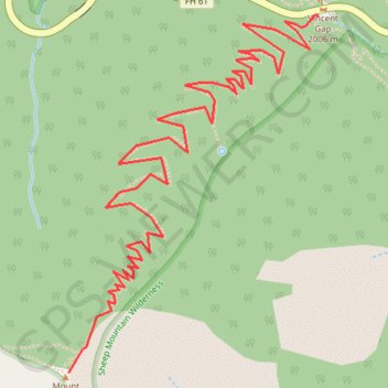
  • Distance: 3.8 mi
  • Elevation gain: 2,812 ft
  • Maximum elevation: 9,364 ft
  • Elevation loss: 56 ft
  • Minimum elevation: 6,608 ft

Interactive trail map

Trail profile

  • Distance: 3.8 mi
  • Elevation gain: 2,812 ft
  • Maximum elevation: 9,364 ft
  • Elevation loss: 56 ft
  • Minimum elevation: 6,608 ft

About this trail

Name: Mount Baden-Powell from Vincent Gap via Pacific Crest Trail in Angeles National Forest trail, distance, elevation, map, profile, GPS track

Start: Angeles Crest Highway, Los Angeles County, California, United States (34.37309 -117.75221)

End: Pacific Crest Trail / Silver Moccasin Trail, Los Angeles County, California, United States (34.35861 -117.76450)

Coordinates: 34.35861 -117.76450 34.37315 -117.75221

Topography: Los Angeles County topographic map, elevation, terrain

Other hiking, mountain biking, running and outdoor activity trails

Click on a trail to view its statistics, map and profile.

Mount Baden-Powell

United States > California > Los Angeles County

Hike from Vincent Gap to Mount Baden-Powell via the Pacific Crest Trail (PCT) in the San Gabriel Mountains National Monument and the Angeles National Forest. #Hiking #Mountain #Nature #Forest #Angeles

Distance: 3.9 mi • Elevation gain: 2,812 ft • Maximum elevation: 9,373 ft

Big Horn Mine

United States > California > Los Angeles County

Hike from Vincent Gap to the Big Horn Abandoned Mine in the Sheep Mountain Wilderness and the Angeles National Forest. #Hiking #Mountain #Nature #Forest #Angeles

Distance: 1.9 mi • Elevation gain: 735 ft • Maximum elevation: 6,923 ft

Mount Baden Powell

United States > California > Los Angeles County

Angeles National Forest. #Hiking #Mountain #Forest #Nature

Distance: 7.9 mi • Elevation gain: 2,854 ft • Maximum elevation: 9,367 ft

Gear up for your next adventure:

🎒Gear Packing Cubes - Organize your backpack efficiently
🛠️Outdoor Gear Repair Kit - Essential tools to fix gear on the trail
🦟Ultrasonic Repellers - Create a bug-free zone at your camp or rest stop
🪓Survival Multi‑Tool - Versatile tool for camp and trail tasks
🧭Outdoor Navigation Book - Learn advanced navigation skills

As an Amazon Associate, this site earns from qualifying purchases at no extra cost to you.