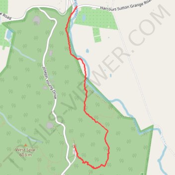
Mount Alexander descent via Leanganook Track
- Distance: 2.7 mi
- Elevation gain: 72 ft
- Maximum elevation: 2,405 ft
- Elevation loss: 1,142 ft
- Minimum elevation: 1,322 ft
- Moving time: 1 h 8 m
- Moving speed: 2.4 mph
- Maximum speed: 12.7 mph
- Total time: 1 h 15 m
- Global speed: 2.2 mph
Interactive trail map
Trail profile
- Distance: 2.7 mi
- Elevation gain: 72 ft
- Maximum elevation: 2,405 ft
- Elevation loss: 1,142 ft
- Minimum elevation: 1,322 ft
- Moving time: 1 h 8 m
- Moving speed: 2.4 mph
- Maximum speed: 12.7 mph
- Total time: 1 h 15 m
- Global speed: 2.2 mph
About this trail
Name: Mount Alexander descent via Leanganook Track trail, distance, elevation, map, profile, GPS track
Coordinates: -36.99439 144.30703 -36.96846 144.31571
Other hiking, mountain biking, running and outdoor activity trails
Click on a trail to view its statistics, map and profile.