Thank you for supporting this site ❤️
Make a donation
Make a donation
Gear up for your next adventure:
As an Amazon Associate, this site earns from qualifying purchases at no extra cost to you.
Amble - Bolam Lake Country Park
Interactive trail map
Thank you for supporting this site ❤️
Make a donation
Make a donation
Gear up for your next adventure:
As an Amazon Associate, this site earns from qualifying purchases at no extra cost to you.
Trail profile
- Distance: 58.7 mi
- Elevation gain: 2,487 ft
- Maximum elevation: 600 ft
- Elevation loss: 2,474 ft
- Minimum elevation: 0 ft
Thank you for supporting this site ❤️
Make a donation
Make a donation
Gear up for your next adventure:
As an Amazon Associate, this site earns from qualifying purchases at no extra cost to you.
About this trail
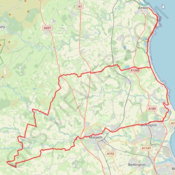
Name: Amble - Bolam Lake Country Park trail, distance, elevation, map, profile, GPS track
Coordinates: 55.12857 -1.89115 55.33372 -1.52636
Thank you for supporting this site ❤️
Make a donation
Make a donation
Gear up for your next adventure:
As an Amazon Associate, this site earns from qualifying purchases at no extra cost to you.