Rail Way
- Distance: 0.7 mi
- Elevation gain: 13 ft
- Maximum elevation: 925 ft
- Elevation loss: 13 ft
- Minimum elevation: 919 ft
- Moving time: 18 m 25 s
- Moving speed: 2.2 mph
- Maximum speed: 16.2 mph
- Total time: 25 m 20 s
- Global speed: 1.6 mph
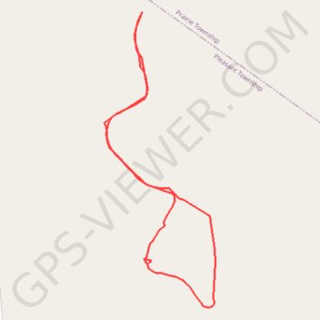
Interactive trail map
Trail profile
- Distance: 0.7 mi
- Elevation gain: 13 ft
- Maximum elevation: 925 ft
- Elevation loss: 13 ft
- Minimum elevation: 919 ft
- Moving time: 18 m 25 s
- Moving speed: 2.2 mph
- Maximum speed: 16.2 mph
- Total time: 25 m 20 s
- Global speed: 1.6 mph
About this trail
Name: Rail Way trail, distance, elevation, map, profile, GPS track
Start: Rail Way, Pleasant Township, Franklin County, Ohio, 43119, United States (39.91261 -83.20800)
End: Rail Way, Pleasant Township, Franklin County, Ohio, 43119, United States (39.91262 -83.20800)
Coordinates: 39.90903 -83.20860 39.91262 -83.20684
Topography: Franklin County topographic map, elevation, terrain
Other hiking, mountain biking, running and outdoor activity trails
Click on a trail to view its statistics, map and profile.
Harrier Loop
United States > Ohio > Franklin County
Distance: 0.6 mi • Elevation gain: 7 ft • Maximum elevation: 928 ft