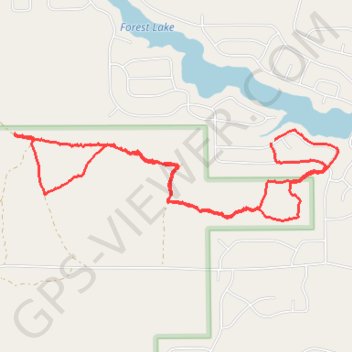
Some trails near Forest Lake, Michigan
- Distance: 5.1 mi
- Elevation gain: 89 ft
- Maximum elevation: 787 ft
- Elevation loss: 89 ft
- Minimum elevation: 755 ft
- Moving time: 1 h 54 m
- Moving speed: 2.7 mph
- Maximum speed: 5.3 mph
- Total time: 1 h 57 m
- Global speed: 2.6 mph
Interactive trail map
Trail profile
- Distance: 5.1 mi
- Elevation gain: 89 ft
- Maximum elevation: 787 ft
- Elevation loss: 89 ft
- Minimum elevation: 755 ft
- Moving time: 1 h 54 m
- Moving speed: 2.7 mph
- Maximum speed: 5.3 mph
- Total time: 1 h 57 m
- Global speed: 2.6 mph
About this trail
Name: Some trails near Forest Lake, Michigan trail, distance, elevation, map, profile, GPS track
Coordinates: 44.11337 -84.08537 44.11942 -84.05485
Topography: Arenac County topographic map, elevation, terrain