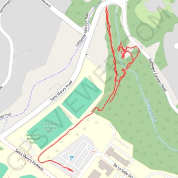
St Mary's ramble
Moraga Walking
- Distance: 1.0 mi
- Elevation gain: 92 ft
- Maximum elevation: 604 ft
- Elevation loss: 75 ft
- Minimum elevation: 551 ft
- Moving time: 29 m 38 s
- Moving speed: 2.0 mph
- Maximum speed: 10.4 mph
- Total time: 41 m 36 s
- Global speed: 1.4 mph
Interactive trail map
Trail profile
- Distance: 1.0 mi
- Elevation gain: 92 ft
- Maximum elevation: 604 ft
- Elevation loss: 75 ft
- Minimum elevation: 551 ft
- Moving time: 29 m 38 s
- Moving speed: 2.0 mph
- Maximum speed: 10.4 mph
- Total time: 41 m 36 s
- Global speed: 1.4 mph
About this trail
Name: St Mary's ramble trail, distance, elevation, map, profile, GPS track
Coordinates: 37.84272 -122.11150 37.84721 -122.10798
Topography: Contra Costa County topographic map, elevation, terrain