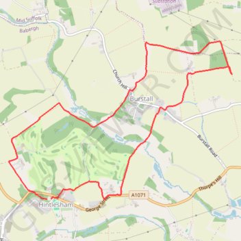
Hintlesham and Burstall loop
- Distance: 5.2 mi
- Elevation gain: 335 ft
- Maximum elevation: 200 ft
- Elevation loss: 331 ft
- Minimum elevation: 62 ft
- Moving time: 2 h 3 m
- Moving speed: 2.5 mph
- Maximum speed: 4.1 mph
- Total time: 2 h 9 m
- Global speed: 2.4 mph
Interactive trail map
Trail profile
- Distance: 5.2 mi
- Elevation gain: 335 ft
- Maximum elevation: 200 ft
- Elevation loss: 331 ft
- Minimum elevation: 62 ft
- Moving time: 2 h 3 m
- Moving speed: 2.5 mph
- Maximum speed: 4.1 mph
- Total time: 2 h 9 m
- Global speed: 2.4 mph
About this trail
Name: Hintlesham and Burstall loop trail, distance, elevation, map, profile, GPS track
Coordinates: 52.04981 1.03476 52.06661 1.07325