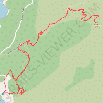
Onahau lookout from Mistletoe Bay
- Distance: 3.3 mi
- Elevation gain: 1,450 ft
- Maximum elevation: 1,276 ft
- Elevation loss: 1,437 ft
- Minimum elevation: 23 ft
- Moving time: 1 h 15 m
- Moving speed: 2.7 mph
- Maximum speed: 10.9 mph
- Total time: 2 h 26 m
- Global speed: 1.4 mph
Interactive trail map
Trail profile
- Distance: 3.3 mi
- Elevation gain: 1,450 ft
- Maximum elevation: 1,276 ft
- Elevation loss: 1,437 ft
- Minimum elevation: 23 ft
- Moving time: 1 h 15 m
- Moving speed: 2.7 mph
- Maximum speed: 10.9 mph
- Total time: 2 h 26 m
- Global speed: 1.4 mph
About this trail
Name: Onahau lookout from Mistletoe Bay trail, distance, elevation, map, profile, GPS track
Coordinates: -41.22272 173.97232 -41.21506 173.98343