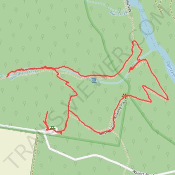
Den of Nargun Loop
- Distance: 2.0 mi
- Elevation gain: 512 ft
- Maximum elevation: 564 ft
- Elevation loss: 489 ft
- Minimum elevation: 203 ft
Interactive trail map
Trail profile
About this trail
Name: Den of Nargun Loop trail, distance, elevation, map, profile, GPS track
Start: Wallers Road, Iguana Creek, Shire of East Gippsland, Victoria, 3875, Australia (-37.70311 147.36046)
End: Wallers Road, Iguana Creek, Shire of East Gippsland, Victoria, 3875, Australia (-37.70372 147.36042)
Coordinates: -37.70408 147.35829 -37.70014 147.36688