West Beach and Dune Succession Trail Loop in Indiana Dunes National Park
The West Beach and Dune Succession Trail Loop offers a unique blend of natural beauty and geological intrigue. Hikers can expect to traverse through lush landscapes leading to sweeping views of Lake Michigan, with opportunities to spot various wildlife in the rich ecosystems formed by the transition from dunes to wetlands. The trail's sandy paths and notable elevation changes present a moderate challenge, rewarding those who venture out with stunning vistas and a deeper understanding of the area's dynamic environment. #Hiking #Loop #Lake #Forest #Nature
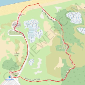
- Distance: 1.0 mi
- Elevation gain: 85 ft
- Maximum elevation: 669 ft
- Elevation loss: 82 ft
- Minimum elevation: 587 ft
- Moving time: 41 m 57 s
- Moving speed: 1.4 mph
- Maximum speed: 3.4 mph
- Total time: 52 m 6 s
- Global speed: 1.1 mph
Interactive trail map
Trail profile
- Distance: 1.0 mi
- Elevation gain: 85 ft
- Maximum elevation: 669 ft
- Elevation loss: 82 ft
- Minimum elevation: 587 ft
- Moving time: 41 m 57 s
- Moving speed: 1.4 mph
- Maximum speed: 3.4 mph
- Total time: 52 m 6 s
- Global speed: 1.1 mph
About this trail
Name: West Beach and Dune Succession Trail Loop in Indiana Dunes National Park trail, distance, elevation, map, profile, GPS track
Coordinates: 41.62241 -87.20848 41.62666 -87.20375
Topography: Porter County topographic map, elevation, terrain
Other hiking, mountain biking, running and outdoor activity trails
Click on a trail to view its statistics, map and profile.
West Beach Trail and Long Lake Trail Loop in Indiana Dunes National Park
United States > Indiana > Porter County > Portage
The West Beach and Long Lake Trail Loop offers a dynamic hiking experience, blending scenic dunes, woodlands, and lake views. This route takes you through sandy stretches and elevated boardwalks, showcasing different stages of dune succession and offering glimpses of Lake Michigan and Long Lake. The moderate…
Distance: 3.5 mi • Elevation gain: 187 ft • Maximum elevation: 669 ft