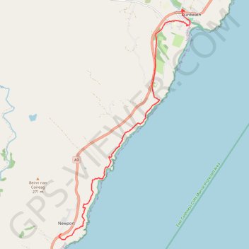
John O'Groats Trail - Berriedale to Dunbeath
- Distance: 6.0 mi
- Elevation gain: 1,404 ft
- Maximum elevation: 502 ft
- Elevation loss: 1,824 ft
- Minimum elevation: 7 ft
- Moving time: 2 h 46 m
- Moving speed: 2.2 mph
- Maximum speed: 3.7 mph
- Total time: 3 h 11 m
- Global speed: 1.9 mph
Interactive trail map
Trail profile
- Distance: 6.0 mi
- Elevation gain: 1,404 ft
- Maximum elevation: 502 ft
- Elevation loss: 1,824 ft
- Minimum elevation: 7 ft
- Moving time: 2 h 46 m
- Moving speed: 2.2 mph
- Maximum speed: 3.7 mph
- Total time: 3 h 11 m
- Global speed: 1.9 mph
About this trail
Name: John O'Groats Trail - Berriedale to Dunbeath trail, distance, elevation, map, profile, GPS track
Start: A9, Langwell House, Berriedale, Highland, Scotland, KW6 6EY, United Kingdom (58.19576 -3.48669)
Coordinates: 58.19426 -3.48764 58.24945 -3.42804
Other hiking, mountain biking, running and outdoor activity trails
Click on a trail to view its statistics, map and profile.
John O'Groats Trail - Helmsdale to Berriedale
United Kingdom > Scotland > Highland > Helmsdale
Distance: 10.9 mi • Elevation gain: 2,661 ft • Maximum elevation: 699 ft
Dunbeath - Dornoch
United Kingdom > Scotland > Highland > Houstry
Distance: 45.3 mi • Elevation gain: 2,946 ft • Maximum elevation: 755 ft