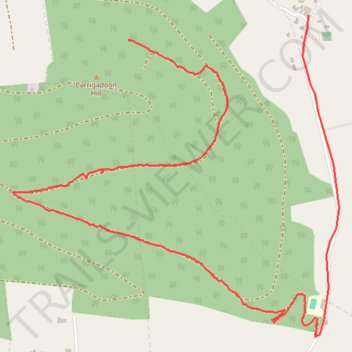
Carrickadoon
- Distance: 3.1 mi
- Elevation gain: 236 ft
- Maximum elevation: 840 ft
- Elevation loss: 738 ft
- Minimum elevation: 207 ft
- Moving time: 50 m 17 s
- Moving speed: 3.7 mph
- Maximum speed: 32.5 mph
- Total time: 58 m 33 s
- Global speed: 3.1 mph
Interactive trail map
Trail profile
- Distance: 3.1 mi
- Elevation gain: 236 ft
- Maximum elevation: 840 ft
- Elevation loss: 738 ft
- Minimum elevation: 207 ft
- Moving time: 50 m 17 s
- Moving speed: 3.7 mph
- Maximum speed: 32.5 mph
- Total time: 58 m 33 s
- Global speed: 3.1 mph
About this trail
Name: Carrickadoon trail, distance, elevation, map, profile, GPS track
Coordinates: 52.40129 -7.41252 52.41328 -7.39263