Thank you for supporting this site ❤️
Make a donation
Make a donation
Gear up for your next adventure:
As an Amazon Associate, this site earns from qualifying purchases at no extra cost to you.
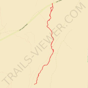
Deer Creek from Lee Canyon Road
- Distance: 6.7 mi
- Elevation gain: 919 ft
- Maximum elevation: 6,191 ft
- Elevation loss: 919 ft
- Minimum elevation: 5,456 ft
- Moving time: 2 h 25 m
- Moving speed: 2.8 mph
- Maximum speed: 3.5 mph
- Total time: 2 h 29 m
- Global speed: 2.7 mph
Interactive trail map
Thank you for supporting this site ❤️
Make a donation
Make a donation
Gear up for your next adventure:
As an Amazon Associate, this site earns from qualifying purchases at no extra cost to you.
Trail profile
- Distance: 6.7 mi
- Elevation gain: 919 ft
- Maximum elevation: 6,191 ft
- Elevation loss: 919 ft
- Minimum elevation: 5,456 ft
- Moving time: 2 h 25 m
- Moving speed: 2.8 mph
- Maximum speed: 3.5 mph
- Total time: 2 h 29 m
- Global speed: 2.7 mph
Thank you for supporting this site ❤️
Make a donation
Make a donation
Gear up for your next adventure:
As an Amazon Associate, this site earns from qualifying purchases at no extra cost to you.
About this trail
Name: Deer Creek from Lee Canyon Road trail, distance, elevation, map, profile, GPS track
Start: Lee Canyon Road, Clark County, Nevada, United States (36.40677 -115.56664)
End: Lee Canyon Road, Clark County, Nevada, United States (36.40685 -115.56660)
Coordinates: 36.36768 -115.57739 36.40685 -115.56579
Topography: Clark County topographic map, elevation, terrain
Thank you for supporting this site ❤️
Make a donation
Make a donation
Gear up for your next adventure:
As an Amazon Associate, this site earns from qualifying purchases at no extra cost to you.