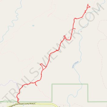
Sand Canyon Trail to Corncob House and Double Cliff House via Castle Rock Pueblo and Saddlehorn Pueblo
- Distance: 4.8 mi
- Elevation gain: 755 ft
- Maximum elevation: 5,830 ft
- Elevation loss: 758 ft
- Minimum elevation: 5,456 ft
- Moving time: 2 h 14 m
- Moving speed: 2.2 mph
- Maximum speed: 3.1 mph
- Total time: 2 h 47 m
- Global speed: 1.7 mph
Interactive trail map
Trail profile
- Distance: 4.8 mi
- Elevation gain: 755 ft
- Maximum elevation: 5,830 ft
- Elevation loss: 758 ft
- Minimum elevation: 5,456 ft
- Moving time: 2 h 14 m
- Moving speed: 2.2 mph
- Maximum speed: 3.1 mph
- Total time: 2 h 47 m
- Global speed: 1.7 mph
About this trail
Name: Sand Canyon Trail to Corncob House and Double Cliff House via Castle Rock Pueblo and Saddlehorn Pueblo trail, distance, elevation, map, profile, GPS track
Start: Sand Canyon Trail, Montezuma County, Colorado, United States (37.34163 -108.81778)
Coordinates: 37.34148 -108.81808 37.36174 -108.79917
Topography: Montezuma County topographic map, elevation, terrain