
Havasu Creek Falls (Fiftyfoot Falls, Navajo Falls, Havasu Falls, Mooney Falls and Beaver Falls)
From Hualapai Hilltop, the route drops through dry switchbacks and open desert canyon toward Supai, a remote Havasupai village set within Havasu Canyon and not accessible by road.
Beyond Supai, the trail follows the blue-green waters of Havasu Creek, passing Fiftyfoot Falls and Navajo Falls before reaching the broad turquoise plunge pool of Havasu Falls.
Downstream, the canyon becomes narrower and more adventurous as the route continues past the campground to the dramatic descent at Mooney Falls, then along creek crossings and travertine terraces to Beaver Falls.
#Hiking #Canyon #Falls #River #Nature #Forest #Waterfalls #Creek #Desert #Adventure
- Distance: 14.5 mi
- Elevation gain: 5,289 ft
- Maximum elevation: 5,184 ft
- Elevation loss: 7,848 ft
- Minimum elevation: 2,346 ft
- Moving time: 5 h 39 m
- Moving speed: 2.6 mph
- Maximum speed: 21.4 mph
- Total time: 1 d 1 h
- Global speed: 0.6 mph
Interactive trail map
Trail profile
- Distance: 14.5 mi
- Elevation gain: 5,289 ft
- Maximum elevation: 5,184 ft
- Elevation loss: 7,848 ft
- Minimum elevation: 2,346 ft
- Moving time: 5 h 39 m
- Moving speed: 2.6 mph
- Maximum speed: 21.4 mph
- Total time: 1 d 1 h
- Global speed: 0.6 mph
About this trail
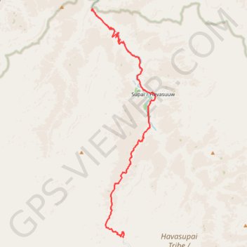
Name: Havasu Creek Falls (Fiftyfoot Falls, Navajo Falls, Havasu Falls, Mooney Falls and Beaver Falls) trail, distance, elevation, map, profile, GPS track
Start: Hualapai Hilltop, Havasu Canyon Trail, Coconino County, Arizona, United States (36.15999 -112.70922)
End: Beaver Falls Trail, Coconino County, Arizona, United States (36.28101 -112.73009)
Coordinates: 36.15994 -112.73012 36.28183 -112.68789
Topography: Coconino County topographic map, elevation, terrain