Make a donation
Gear up for your next adventure:
As an Amazon Associate, this site earns from qualifying purchases at no extra cost to you.
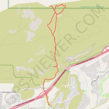
Grapevine Wash and other trails
- Distance: 6.9 mi
- Elevation gain: 545 ft
- Maximum elevation: 3,671 ft
- Elevation loss: 909 ft
- Minimum elevation: 2,917 ft
- Moving time: 2 h 45 m
- Moving speed: 2.5 mph
- Maximum speed: 5.1 mph
- Total time: 3 h 19 m
- Global speed: 2.1 mph
Interactive trail map
Make a donation
Gear up for your next adventure:
As an Amazon Associate, this site earns from qualifying purchases at no extra cost to you.
Trail profile
- Distance: 6.9 mi
- Elevation gain: 545 ft
- Maximum elevation: 3,671 ft
- Elevation loss: 909 ft
- Minimum elevation: 2,917 ft
- Moving time: 2 h 45 m
- Moving speed: 2.5 mph
- Maximum speed: 5.1 mph
- Total time: 3 h 19 m
- Global speed: 2.1 mph
Make a donation
Gear up for your next adventure:
As an Amazon Associate, this site earns from qualifying purchases at no extra cost to you.
About this trail
Name: Grapevine Wash and other trails trail, distance, elevation, map, profile, GPS track
Start: Dino Cliffs, Washington, Washington County, Utah, 84780, United States (37.15901 -113.48214)
Coordinates: 37.14291 -113.48773 37.18567 -113.47557
Topography: Washington County topographic map, elevation, terrain
Make a donation
Gear up for your next adventure:
As an Amazon Associate, this site earns from qualifying purchases at no extra cost to you.
Other hiking, mountain biking, running and outdoor activity trails
Click on a trail to view its statistics, map and profile.
Grapevine, Church Rocks, Spanish Wash and Bracken's Trails Loop in Red Cliffs National Conservation Area
United States > Utah > Washington County > Washington
Distance: 10.6 mi • Elevation gain: 1,102 ft • Maximum elevation: 3,612 ft