Thank you for supporting this site ❤️
Make a donation
Make a donation
Gear up for your next adventure:
As an Amazon Associate, this site earns from qualifying purchases at no extra cost to you.
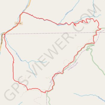
Scotch Creek -> Salt Creek Loop, Rico, CO
Interactive trail map
Thank you for supporting this site ❤️
Make a donation
Make a donation
Gear up for your next adventure:
As an Amazon Associate, this site earns from qualifying purchases at no extra cost to you.
Trail profile
- Distance: 19.6 mi
- Elevation gain: 3,711 ft
- Maximum elevation: 10,928 ft
- Elevation loss: 3,711 ft
- Minimum elevation: 8,451 ft
- Moving time: 3 h 26 m
- Moving speed: 5.7 mph
- Maximum speed: 27.0 mph
- Total time: 5 h 12 m
- Global speed: 3.8 mph
Thank you for supporting this site ❤️
Make a donation
Make a donation
Gear up for your next adventure:
As an Amazon Associate, this site earns from qualifying purchases at no extra cost to you.
About this trail
Name: Scotch Creek -> Salt Creek Loop, Rico, CO trail, distance, elevation, map, profile, GPS track
Start: State Highway 145, Dolores County, Colorado, United States (37.65123 -108.04751)
End: State Highway 145, Dolores County, Colorado, United States (37.65121 -108.04747)
Coordinates: 37.59015 -108.06333 37.65365 -107.96686
Topography: Dolores County topographic map, elevation, terrain
Thank you for supporting this site ❤️
Make a donation
Make a donation
Gear up for your next adventure:
As an Amazon Associate, this site earns from qualifying purchases at no extra cost to you.