Thank you for supporting this site ❤️
Make a donation
Make a donation
Gear up for your next adventure:
As an Amazon Associate, this site earns from qualifying purchases at no extra cost to you.
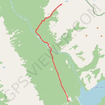
Solstice Lake
#Banff #National #Park #Solstice #Lake #Spectral #Peak #Mountain #Rockies #Canada #Hiking #Route
- Distance: 8.2 mi
- Elevation gain: 2,910 ft
- Maximum elevation: 7,306 ft
- Elevation loss: 407 ft
- Minimum elevation: 4,797 ft
- Moving time: 4 h 13 m
- Moving speed: 1.9 mph
- Maximum speed: 7.7 mph
- Total time: 5 h 9 m
- Global speed: 1.6 mph
Interactive trail map
Thank you for supporting this site ❤️
Make a donation
Make a donation
Gear up for your next adventure:
As an Amazon Associate, this site earns from qualifying purchases at no extra cost to you.
Trail profile
- Distance: 8.2 mi
- Elevation gain: 2,910 ft
- Maximum elevation: 7,306 ft
- Elevation loss: 407 ft
- Minimum elevation: 4,797 ft
- Moving time: 4 h 13 m
- Moving speed: 1.9 mph
- Maximum speed: 7.7 mph
- Total time: 5 h 9 m
- Global speed: 1.6 mph
Thank you for supporting this site ❤️
Make a donation
Make a donation
Gear up for your next adventure:
As an Amazon Associate, this site earns from qualifying purchases at no extra cost to you.
About this trail
Name: Solstice Lake trail, distance, elevation, map, profile, GPS track
Start: Cascade Trail, Improvement District No. 9, Alberta, Canada (51.24458 -115.50928)
End: Improvement District No. 9, Alberta, Canada (51.32630 -115.51923)
Coordinates: 51.24453 -115.55496 51.32630 -115.50928
Thank you for supporting this site ❤️
Make a donation
Make a donation
Gear up for your next adventure:
As an Amazon Associate, this site earns from qualifying purchases at no extra cost to you.