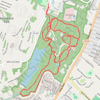
Rifle Camp Park Hardtailing
- Distance: 10.8 mi
- Elevation gain: 860 ft
- Maximum elevation: 541 ft
- Elevation loss: 860 ft
- Minimum elevation: 367 ft
- Moving time: 1 h 47 m
- Moving speed: 6.0 mph
- Maximum speed: 28.2 mph
- Total time: 1 h 55 m
- Global speed: 5.6 mph
Interactive trail map
Trail profile
- Distance: 10.8 mi
- Elevation gain: 860 ft
- Maximum elevation: 541 ft
- Elevation loss: 860 ft
- Minimum elevation: 367 ft
- Moving time: 1 h 47 m
- Moving speed: 6.0 mph
- Maximum speed: 28.2 mph
- Total time: 1 h 55 m
- Global speed: 5.6 mph
About this trail
Name: Rifle Camp Park Hardtailing trail, distance, elevation, map, profile, GPS track
Coordinates: 40.87592 -74.19384 40.89219 -74.17994
Topography: Passaic County topographic map, elevation, terrain