
Orange trailblazed trail in the Erie County Forest
- Distance: 2.6 mi
- Elevation gain: 230 ft
- Maximum elevation: 1,716 ft
- Elevation loss: 400 ft
- Minimum elevation: 1,463 ft
- Moving time: 1 h 4 m
- Moving speed: 2.4 mph
- Maximum speed: 6.8 mph
- Total time: 1 h 36 m
- Global speed: 1.6 mph
Interactive trail map
Trail profile
- Distance: 2.6 mi
- Elevation gain: 230 ft
- Maximum elevation: 1,716 ft
- Elevation loss: 400 ft
- Minimum elevation: 1,463 ft
- Moving time: 1 h 4 m
- Moving speed: 2.4 mph
- Maximum speed: 6.8 mph
- Total time: 1 h 36 m
- Global speed: 1.6 mph
About this trail
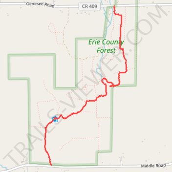
Name: Orange trailblazed trail in the Erie County Forest trail, distance, elevation, map, profile, GPS track
Start: Genesee Road, Town of Sardinia, Erie County, New York, 14055, United States (42.55080 -78.57058)
Coordinates: 42.52942 -78.58329 42.55080 -78.56833
Topography: Erie County topographic map, elevation, terrain