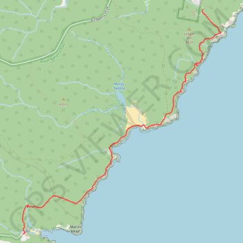
Royal National Park - Coast Track
Interactive trail map
Trail profile
- Distance: 5.8 mi
- Elevation gain: 965 ft
- Maximum elevation: 253 ft
- Elevation loss: 1,056 ft
- Minimum elevation: -3 ft
- Moving time: 2 h 10 m
- Moving speed: 2.7 mph
- Maximum speed: 4.4 mph
- Total time: 2 h 47 m
- Global speed: 2.1 mph
About this trail
Name: Royal National Park - Coast Track trail, distance, elevation, map, profile, GPS track
Coordinates: -34.13787 151.11402 -34.09269 151.16202
Other hiking, mountain biking, running and outdoor activity trails
Click on a trail to view its statistics, map and profile.