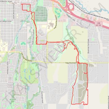
Thank you for supporting this site ❤️
Make a donation
Make a donation
Gear up for your next adventure:
As an Amazon Associate, this site earns from qualifying purchases at no extra cost to you.
Painted Hills ride
- Distance: 9.6 mi
- Elevation gain: 797 ft
- Maximum elevation: 5,174 ft
- Elevation loss: 797 ft
- Minimum elevation: 4,829 ft
- Moving time: 1 h 9 m
- Moving speed: 8.3 mph
- Maximum speed: 22.6 mph
- Total time: 1 h 9 m
- Global speed: 8.3 mph
Interactive trail map
Thank you for supporting this site ❤️
Make a donation
Make a donation
Gear up for your next adventure:
As an Amazon Associate, this site earns from qualifying purchases at no extra cost to you.
Trail profile
- Distance: 9.6 mi
- Elevation gain: 797 ft
- Maximum elevation: 5,174 ft
- Elevation loss: 797 ft
- Minimum elevation: 4,829 ft
- Moving time: 1 h 9 m
- Moving speed: 8.3 mph
- Maximum speed: 22.6 mph
- Total time: 1 h 9 m
- Global speed: 8.3 mph
Thank you for supporting this site ❤️
Make a donation
Make a donation
Gear up for your next adventure:
As an Amazon Associate, this site earns from qualifying purchases at no extra cost to you.
About this trail
Name: Painted Hills ride trail, distance, elevation, map, profile, GPS track
Coordinates: 45.64153 -111.03495 45.67728 -111.00106
Topography: Bozeman topographic map, elevation, terrain
Thank you for supporting this site ❤️
Make a donation
Make a donation
Gear up for your next adventure:
As an Amazon Associate, this site earns from qualifying purchases at no extra cost to you.