Richardson Creek Loop Trail in Homochitto National Forest
The Richardson Creek Loop Trail offers a scenic and enjoyable hiking experience through a variety of landscapes. Hikers can expect to traverse young pine stands and rugged hardwood bottoms, featuring impressive old-growth trees, while enjoying the opportunity for wildlife viewing in a peaceful, well-marked environment. #Hiking #Loop #Forest #Nature
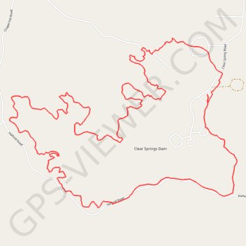
- Distance: 8.3 mi
- Elevation gain: 656 ft
- Maximum elevation: 410 ft
- Elevation loss: 656 ft
- Minimum elevation: 233 ft
- Moving time: 3 h 24 m
- Moving speed: 2.4 mph
- Maximum speed: 5.7 mph
- Total time: 3 h 47 m
- Global speed: 2.2 mph
Interactive trail map
Trail profile
- Distance: 8.3 mi
- Elevation gain: 656 ft
- Maximum elevation: 410 ft
- Elevation loss: 656 ft
- Minimum elevation: 233 ft
- Moving time: 3 h 24 m
- Moving speed: 2.4 mph
- Maximum speed: 5.7 mph
- Total time: 3 h 47 m
- Global speed: 2.2 mph
About this trail
Name: Richardson Creek Loop Trail in Homochitto National Forest trail, distance, elevation, map, profile, GPS track
Start: Franklin County, Mississippi, United States (31.42976 -90.98344)
End: Franklin County, Mississippi, United States (31.43003 -90.98356)
Coordinates: 31.41891 -91.00630 31.43553 -90.98017
Topography: Franklin County topographic map, elevation, terrain